Living with natural hazards
The establishment of GeoNet in 2001 was a landmark achievement in New Zealand science, responding to the country’s unique position on the boundary between the Pacific and Australian tectonic plates. Formed through a partnership between GNS Science, Natural Hazards Commission Toka Tū Ake, and Land Information New Zealand, GeoNet was created to build a modern, nationwide system for monitoring earthquakes, volcanoes, landslides, tsunami, and ground deformation.
Its importance lies in providing consistent, high‑quality, real‑time information in a country where damaging geological events can occur anywhere and affect society, infrastructure, and the economy as a whole. Before GeoNet, hazard monitoring systems were fragmented and limited. GeoNet unified data collection through hundreds of instruments, modern communications, and automated analysis, giving scientists and emergency managers timely insight into rapidly evolving events.
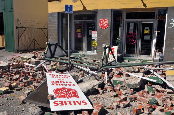
GeoNet’s capability was critical during the Canterbury earthquakes which caused widespread damage. Photo: Earth Sciences NZ.
This capability proved critical during major events such as the Canterbury earthquakes, when GeoNet delivered trusted information to the public and data to researchers, helping shape response efforts and long‑term recovery. By making its data freely available, GeoNet has also enabled advances in engineering standards, risk modelling, insurance assessment, and public awareness, delivering benefits well beyond immediate hazard response.
Today, GeoNet underpins New Zealand’s geohazard science and operations, supporting round‑the‑clock monitoring, research, and public communication. It continues to evolve, laying the foundation for future technologies, stronger resilience, and a safer society in an active and changing landscape.