
Collecting oceans of data
Unseen by most, a fleet of more than 4000 hi-tech floats drift along the ocean’s currents collecting global ocean data. They are called Argo floats, and this network improves our understanding of our oceans, their role in our climate, and our weather and climate prediction systems.
Over a quarter of the global array of floats have been deployed by New Zealand vessels from the beginning of the programme in 1999. Since then regular voyages by RV Kaharoa have deployed 100-160 floats each year since 2004.
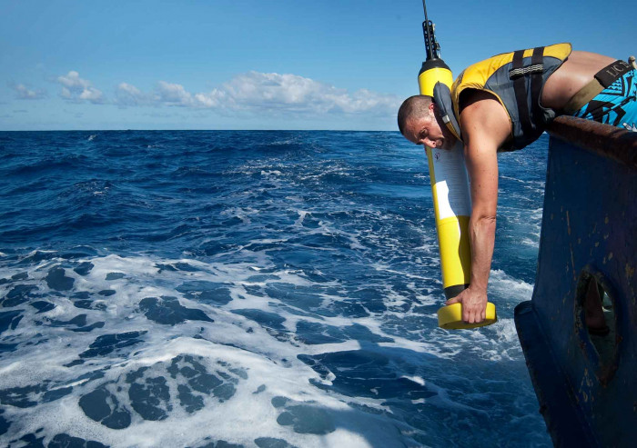
An Argo float is dropped into the ocean off RV Kaharoa – it will measure temperature and salinity in the water column. Photo: Earth Sciences NZ
A typical Argo float cycle begins with a descent to about 1km below sea level. After nine days at this depth, the float then sinks down to 2km before coming back up to the ocean surface. As the float rises, it measures temperature and salinity through the water column.
Once on the surface, these data, along with the position of the float, are transmitted via satellite to data facilities, before the float repeats the cycle. The floats deliver near-real time Argo data. Information is made freely available from websites in the US and Europe and are used globally for forecasting. The data they produce are are critical for prediction of climate extreme weather events.
Thousands of peer-reviewed scientific papers have used Argo data. Topics include air-sea interaction, ocean circulation and ventilation and ocean dynamics. A recent study in New Zealand usedthe data to show that full-depth ocean warming has occurred south of the Chatham Islands at around five times the global rate with possible impacts for critical fisheries.