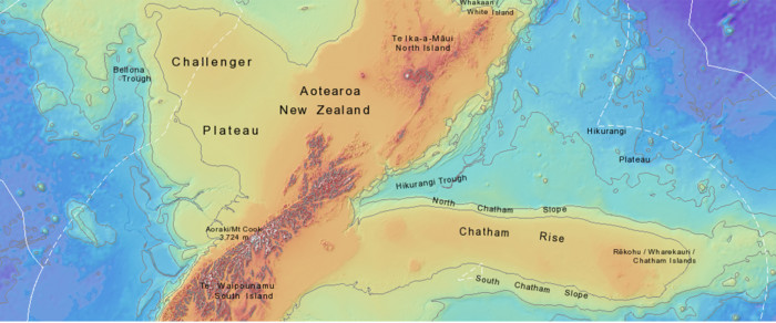
Finding Zealandia
In 2017, GNS scientists confirmed New Zealand is not just a country of islands, but in fact forms some of the few areas of land of the highest points of the world’s eighth and smallest continent, now called Te Riu-a-Māu Zealandia.
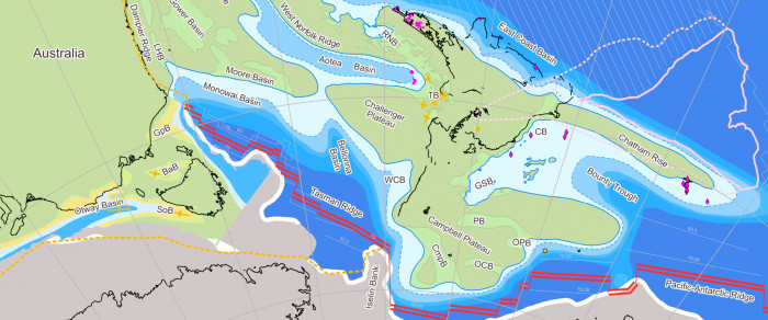
This achievement was made through decades of geological and geophysical research on land and offshore. By bringing together data from geological and bathymetric mapping, seismic surveys, rock samples, gravity data, and plate tectonic modelling, the team demonstrated that Zealandia meets all the criteria of a continent.
The discovery changed how continents are defined. Until then, continents were assumed to be large, mostly dry landmasses. Zealandia showed that continental crust can be stretched, thinned, and largely submerged while still remaining a continent.
The team discovered Zealandia separated from Gondwana between 100 and 60 million years ago, as shown by sedimentary rocks in basins both onshore and offshore New Zealand, all the way to New Caledonia, which formed during the stretching of the crust before Zealandia finally split away. This volcanic region covers an area of 250,000 km2 underwater, about the size of New Zealand itself.
All this evidence helped improve the global understanding of how continents interact, break apart, and evolve.
Recognising Zealandia has also changed how earth science is done in New Zealand, which can now be understood within a single continental framework. This understanding has improved our hazard models, resource assessments, and marine governance.
And even though it was the last continent to be discovered, the team achieved a world-first in 2023, Zealandia became the first ever continent to be fully mapped to its edges.