
Understanding New Zealand's soils
In June 1930, the Prime Minister George Forbes announced what became the national “Soil Bureau” to help answer soil-related problems in farming, including the central North Island ‘bush sickness’ problem. Solving bush sickness (which turned out to be caused by a cobalt deficiency in the soil, leading to vitamin deficiency in livestock) in New Zealand agriculture unlocked massive areas of previously unproductive land, particularly in the central North Island pumice country.
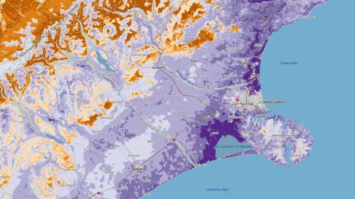
Screenshot from S-map, the digital soils map for New Zealand
It’s hard to overstate the importance of soils and soil science to our nation’s prosperity. By enabling the successful rearing of sheep and cattle on these volcanic soils, the discovery of cobalt supplementation allowed the expansion of productive pastoral farming, directly responsible for wool exports increasing by 37% and frozen meat by 183% between 1950 and 1960.
Over time, soil science has evolved from a small lab in a leaky garage on Molesworth Street in Wellington to a range of soil lab capabilities, nationally significant intergenerational databases, and a large team of soil scientists and pedologists with expertise in all aspects of New Zealand (and Pacific Island) soils and land use pressures – from crop productivity to contaminated land to soil carbon – the list goes on. The nationally significant online soil map (S-map) has identified 4,844 soil types in the 12 million hectares of the country mapped so far. It is heavily relied on by farmers, fertiliser companies, councils, banks and insurers – any organisation with an active interest in land management.