Soils on the move
As well as foundational soil science and mapping, scientists have decades of expertise in soil erosion, sediment processes, and their mitigation. This is important work for the agriculture, horticulture, and forestry sectors, because soil underpins production. It’s also vital to help regional councils meet national freshwater objectives for catchment management.
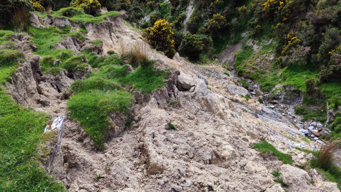
Erosion at the toe of an earth flow
Soil erosion processes are notably active in New Zealand: steep slopes, generally weak sedimentary rocks, and high annual rainfall totals including frequent large rainfall events, underscored by a history of vegetation clearance for agriculture, result in 192 million tonnes of soil being eroded every year, contributing about 10 times the global average sediment yield to oceans. These rates are anticipated to increase significantly under future climate.
Severe erosion caused by storms in the 1930s and 1940s, alongside recognition of the impacts of land use, resulted in the passing of the Soil Conservation and Rivers Control Act. Since then, substantial effort has gone into establishing effective practices for erosion control in New Zealand.
Recent research has provided significant advances in understanding soil erosion, sediment transport, and their mitigation and costs. This included semi-automated landslide mapping tools; LiDAR (Light Detection and Ranging) based landslide susceptibility, connectivity, and mitigation models; and improved understanding of the links between erosion and sediment-related water quality.
The erosion and sediment model, SedNetNZ, is one of the most widely used tools for freshwater management in New Zealand, and New Zealand scientists are internationally acknowledged as experts in sediment "fingerprinting" – tracing where sediment originated.